
Location: Aguascalientes,
México
Year: 2019
México
Year: 2019
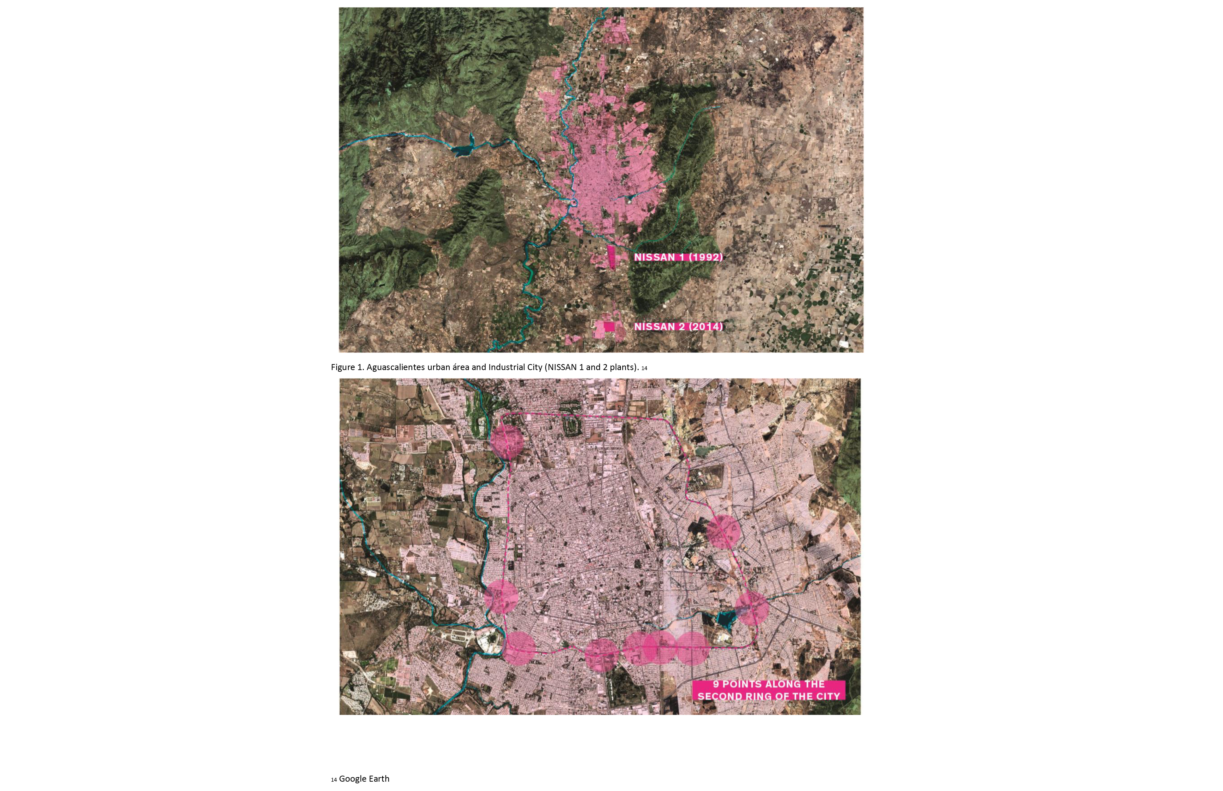
The purpose of this research is to
document the repetition of models of urbanization that have been proven and
have failed in the past. A particular model of development that is strongly nested
in a central region in México commonly known as “Bajío”, this region host most
of the foreign car plants of the country. Here, I will focus on Aguascalientes,
a small State in the middle of the country and this region.
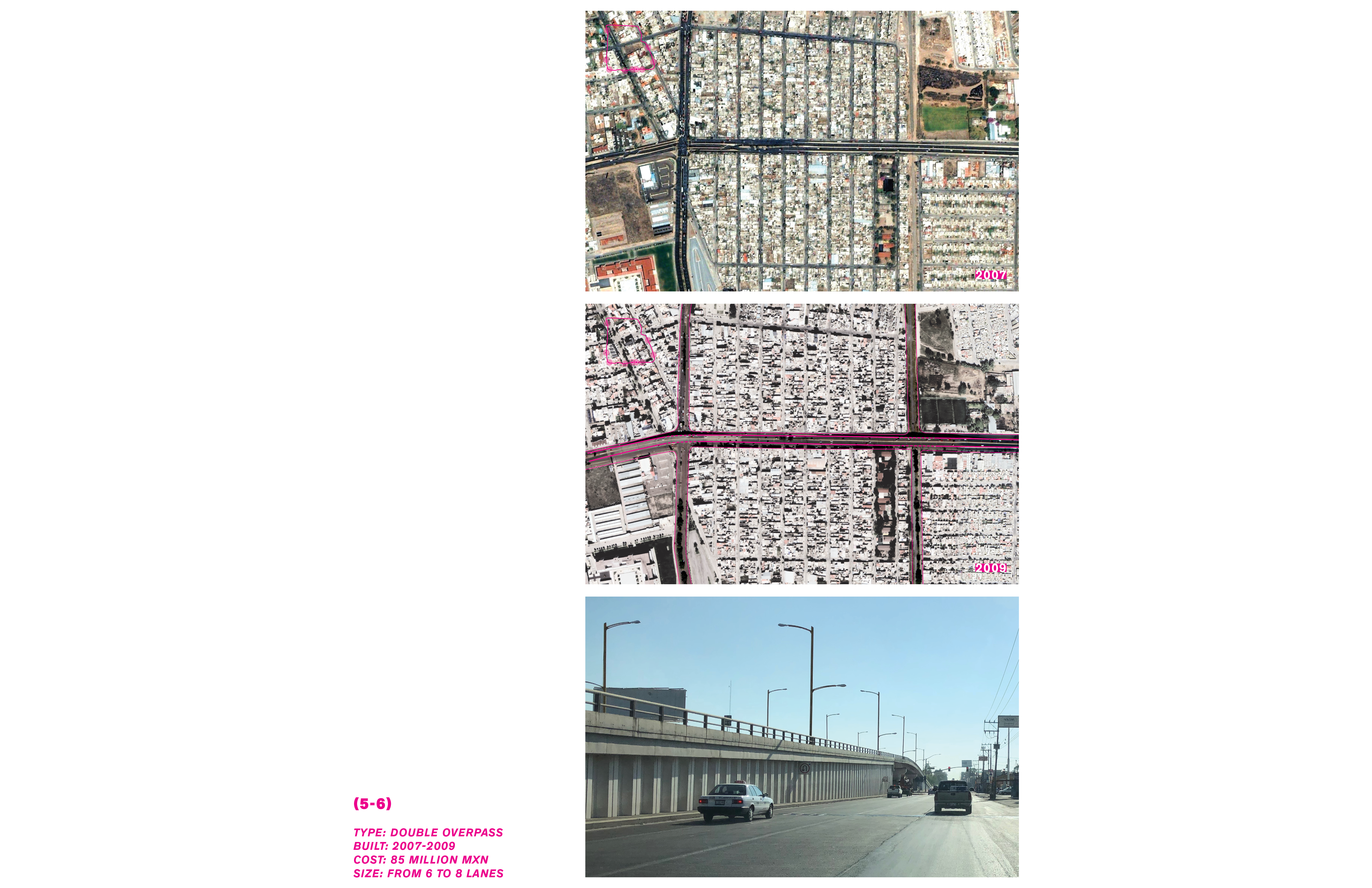
In the last 15 years, this city has
been transforming road intersections of one of its main avenues, the “second
ring” was once the periphery of the city, but today it has become central due to
the expansion of the city. For this reason, the city has opted for transforming
this avenue, it has going from low speed, sometimes pedestrian crossings to
high speed walled crossings with underpasses, overpasses and elevated highways.
These transformations damage the urban fabric, and have negative social impacts
for the neighborhoods around them. Through a series of personal photographs and
collected images from Google Earth I exhibit the before and after, and the
current spatial conditions of this growing Highway City.
The research paper includes a timeline diagram that illustrates the history and evolution of the city.
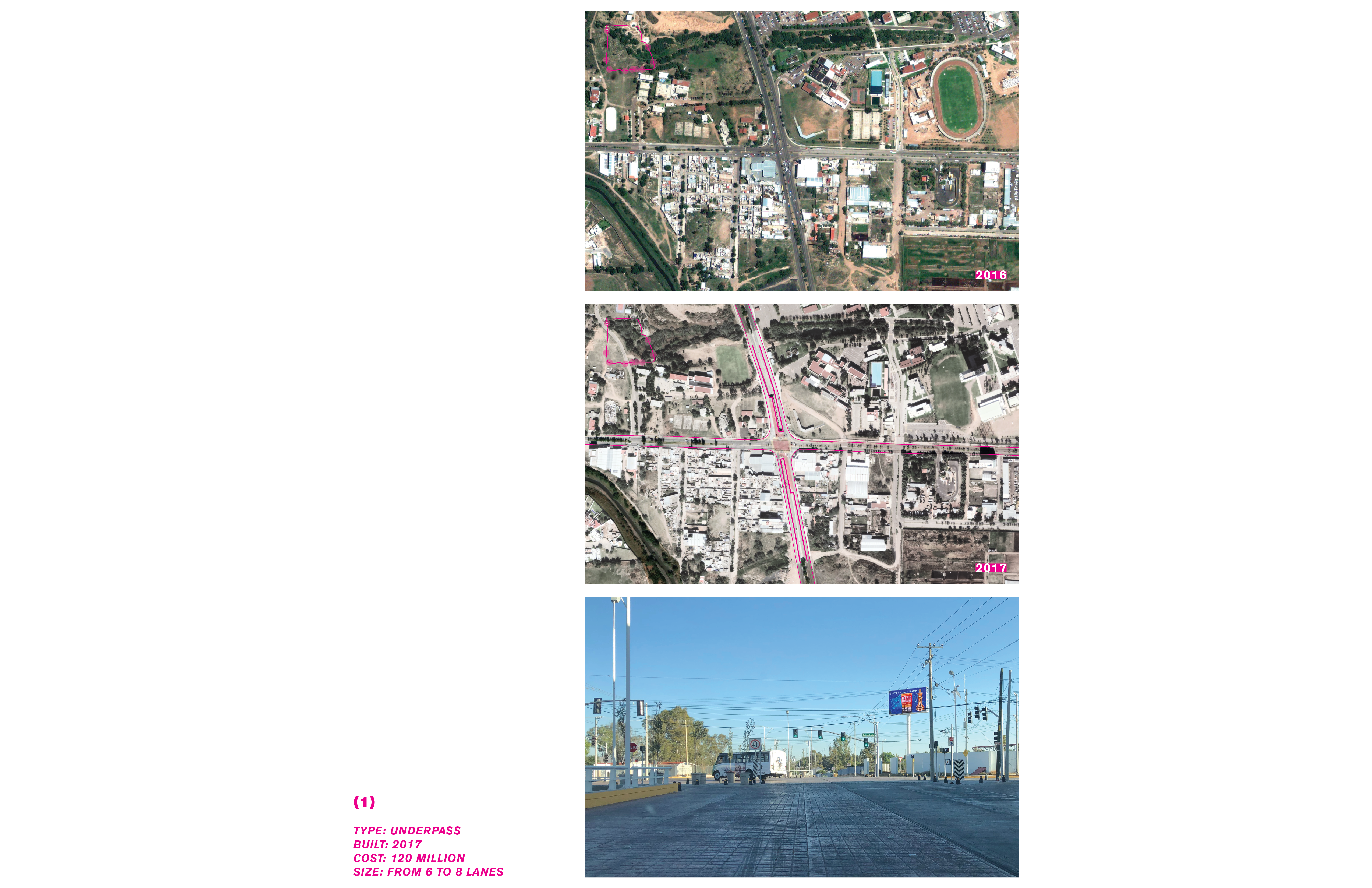
Research paper (slide to view)


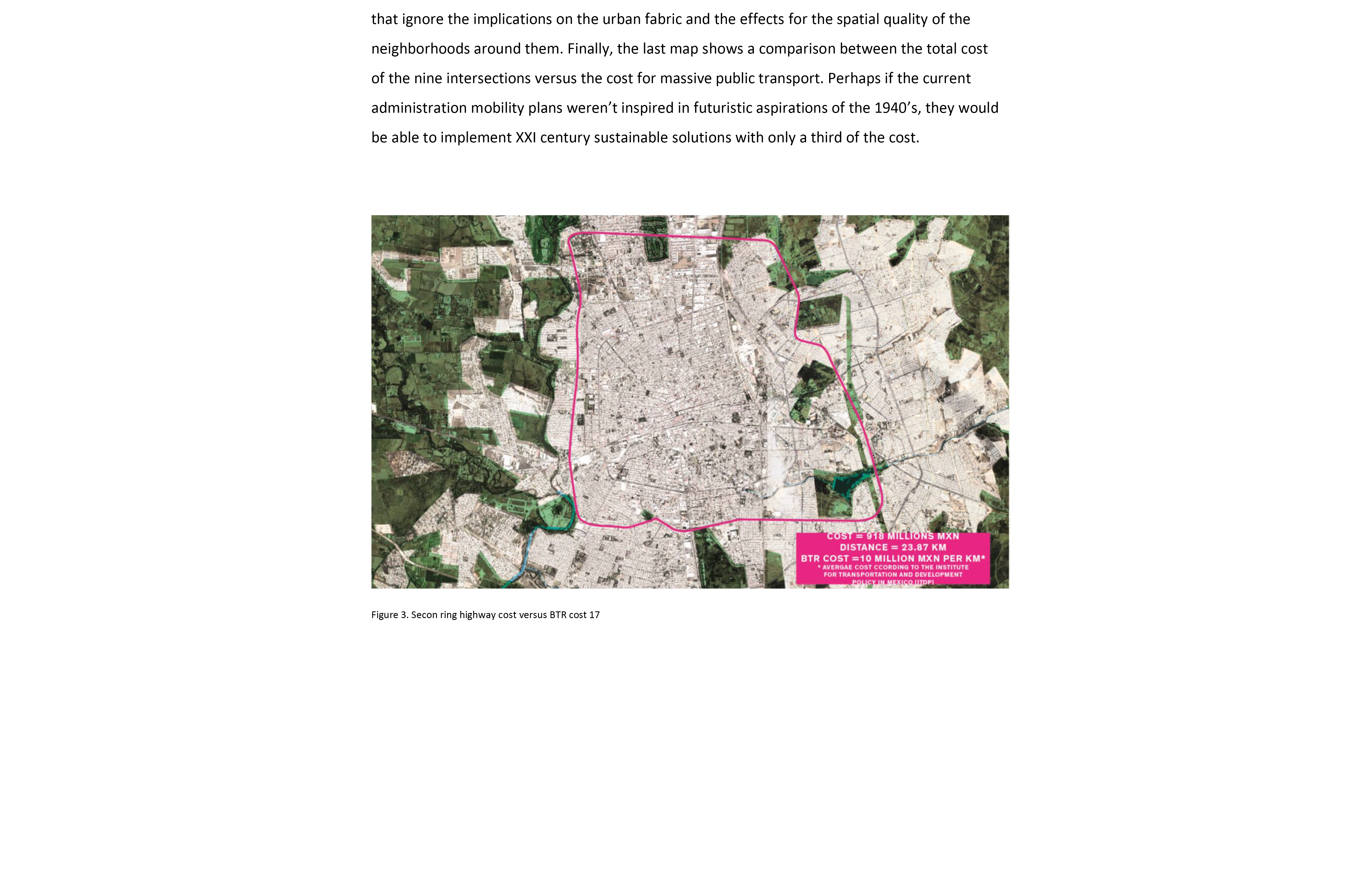
Intersections (slide to view)


Timeline

