Location:
Mumbai, India
Year:
2019
Mumbai, India
Year:
2019
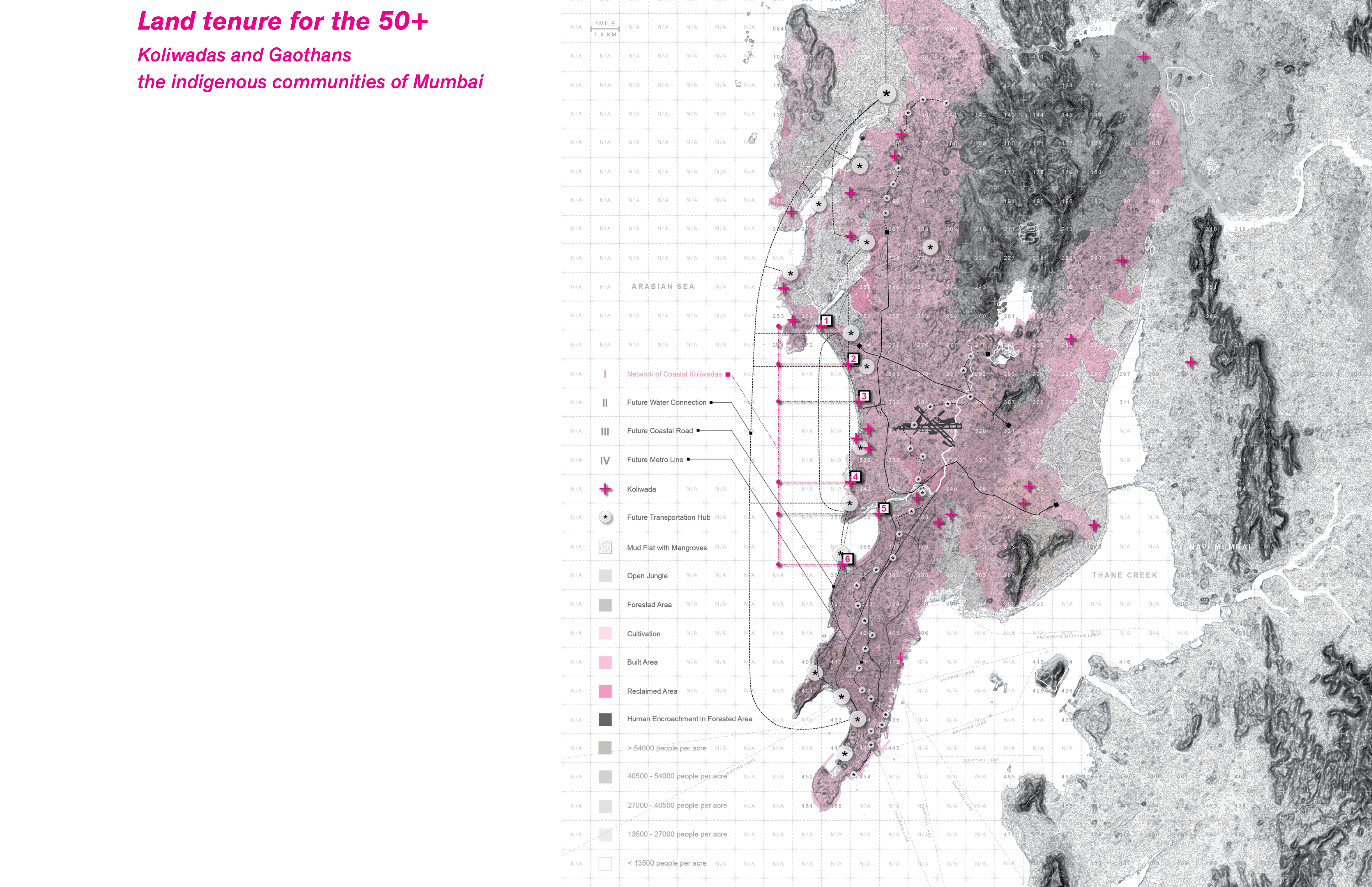
Since the arrival of the first Portuguese expeditions to present day Mumbai the Koliwadas have been threatened, marginalized and displaced from their original settlements. For the city, the villages are seeing as remnant spaces that suffer from a declining fishing economy.
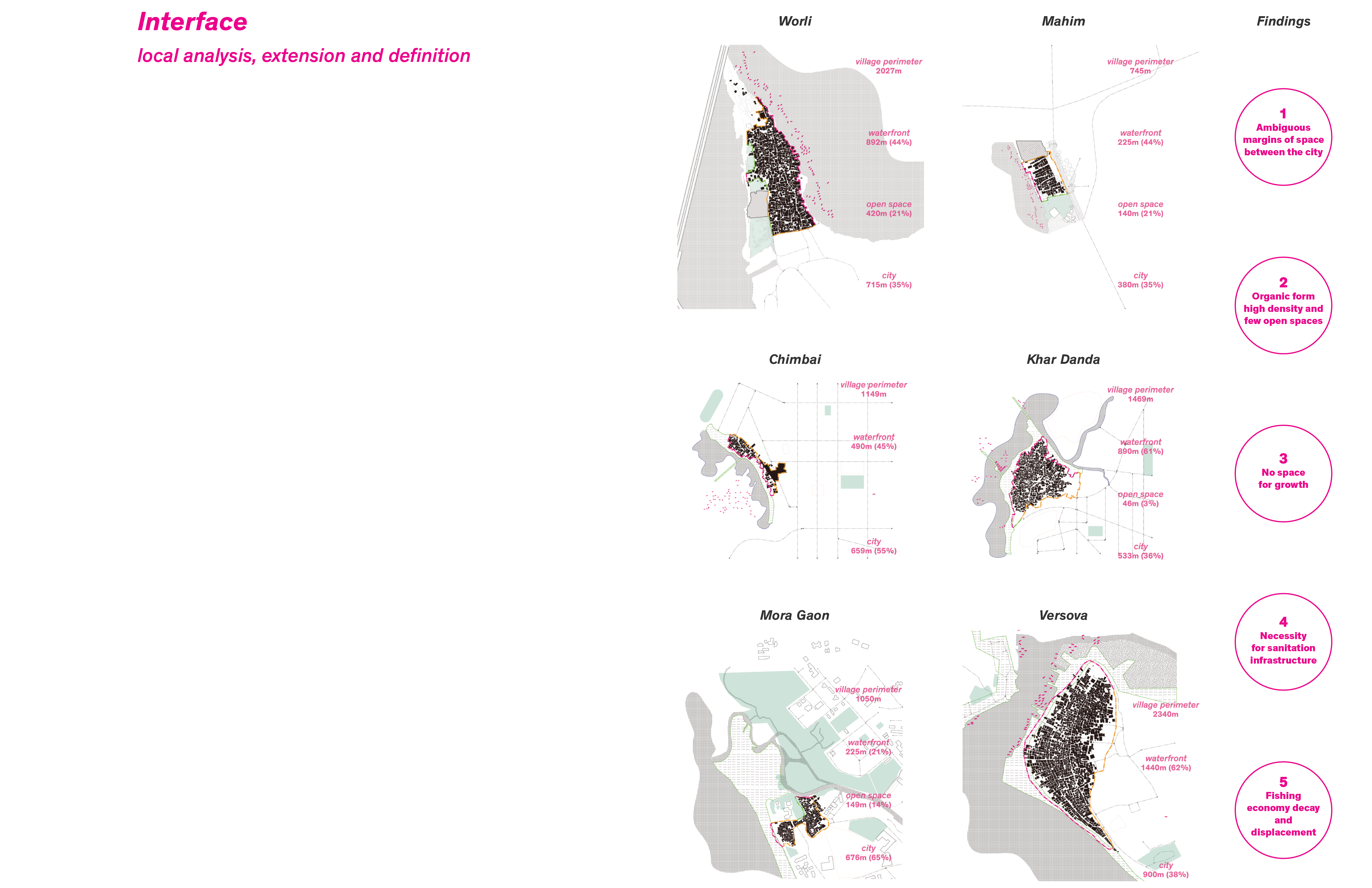
The project begins with the assumption that the indigenous communities of Mumbai are going to receive land tenure and will proceed with formation of a community land trust. With this status, the Kolis are going to be able to negotiate a form of development that would be appropriate for them. When the time for negotiation comes they will need precise information regarding the definition of the boundaries of the village. Unfortunately, the interface and margins of space between the village and the city are vague, they could be defined as no man’s land. Which means that the government or anyone could claim this space, due to this ambiguity the government could, in the worst situation, even appropriate the land from them.
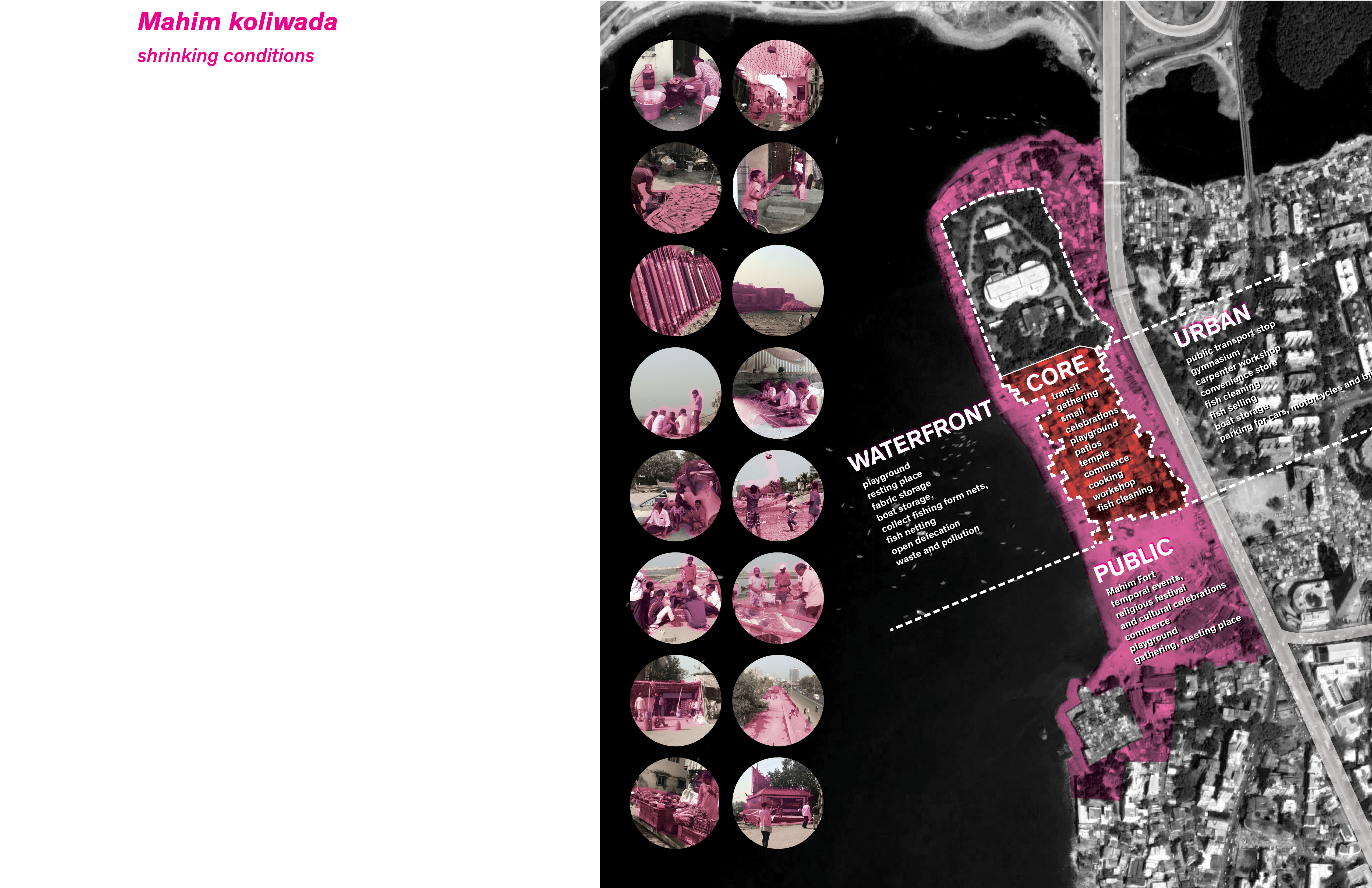
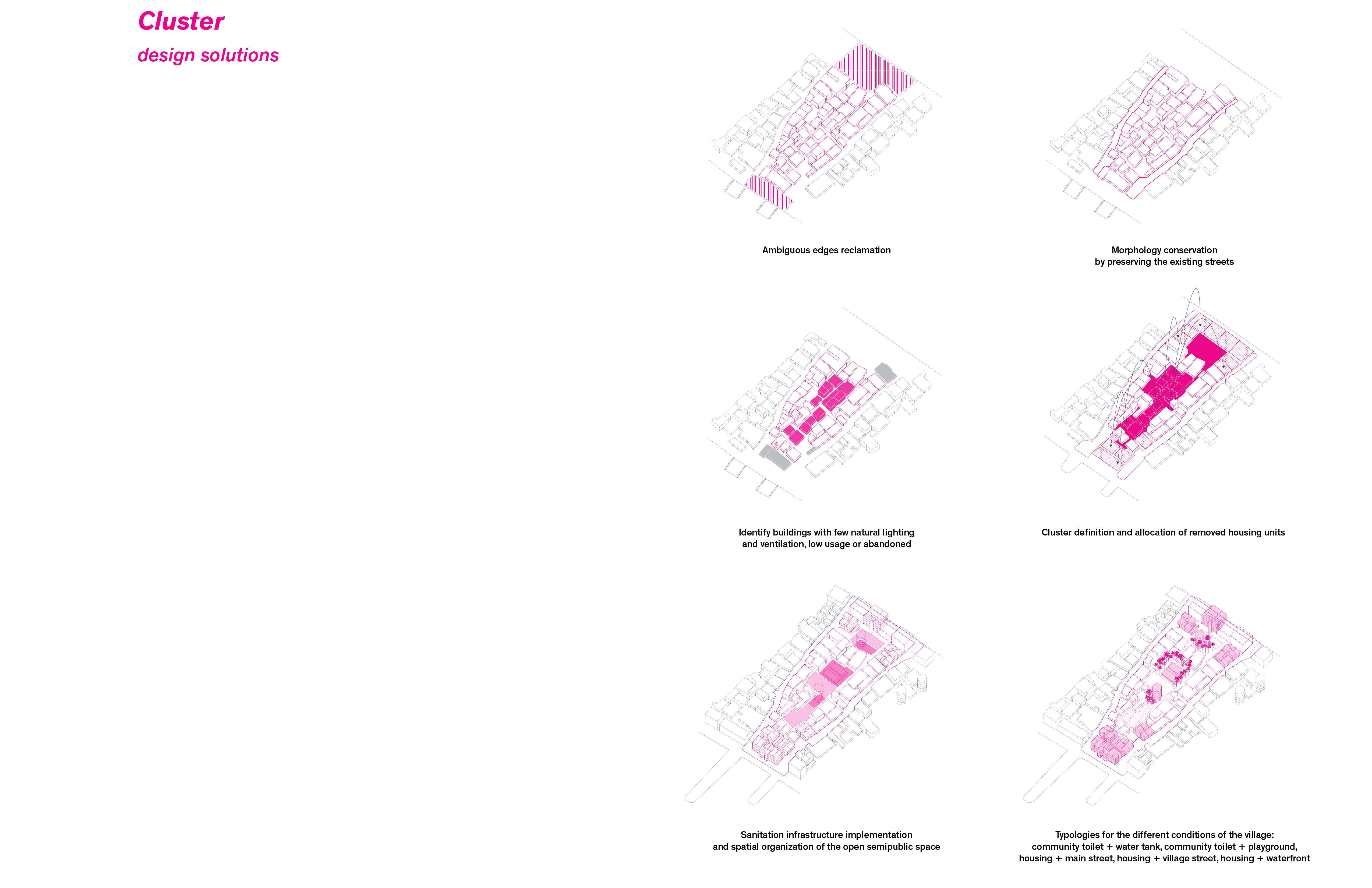
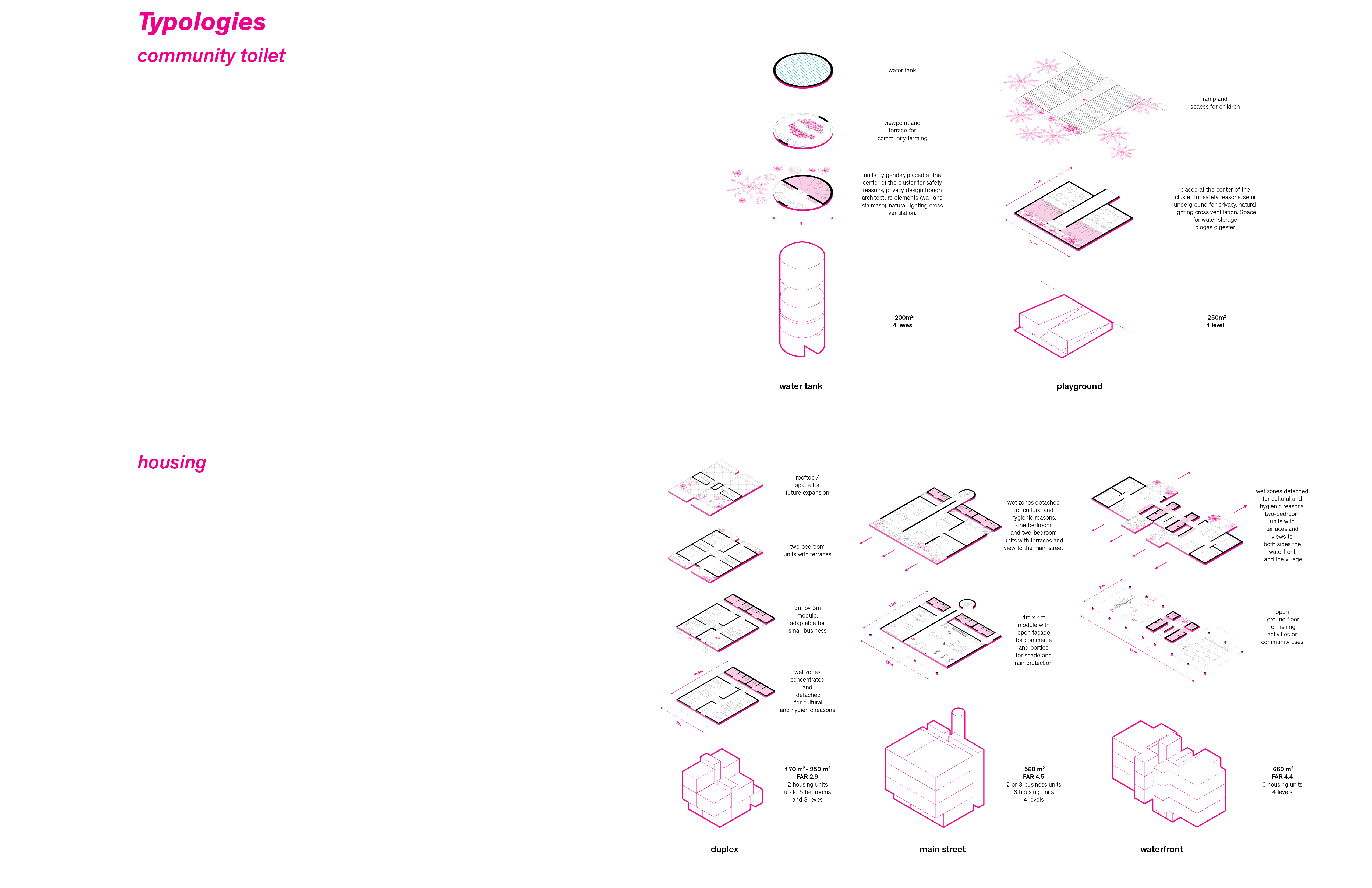
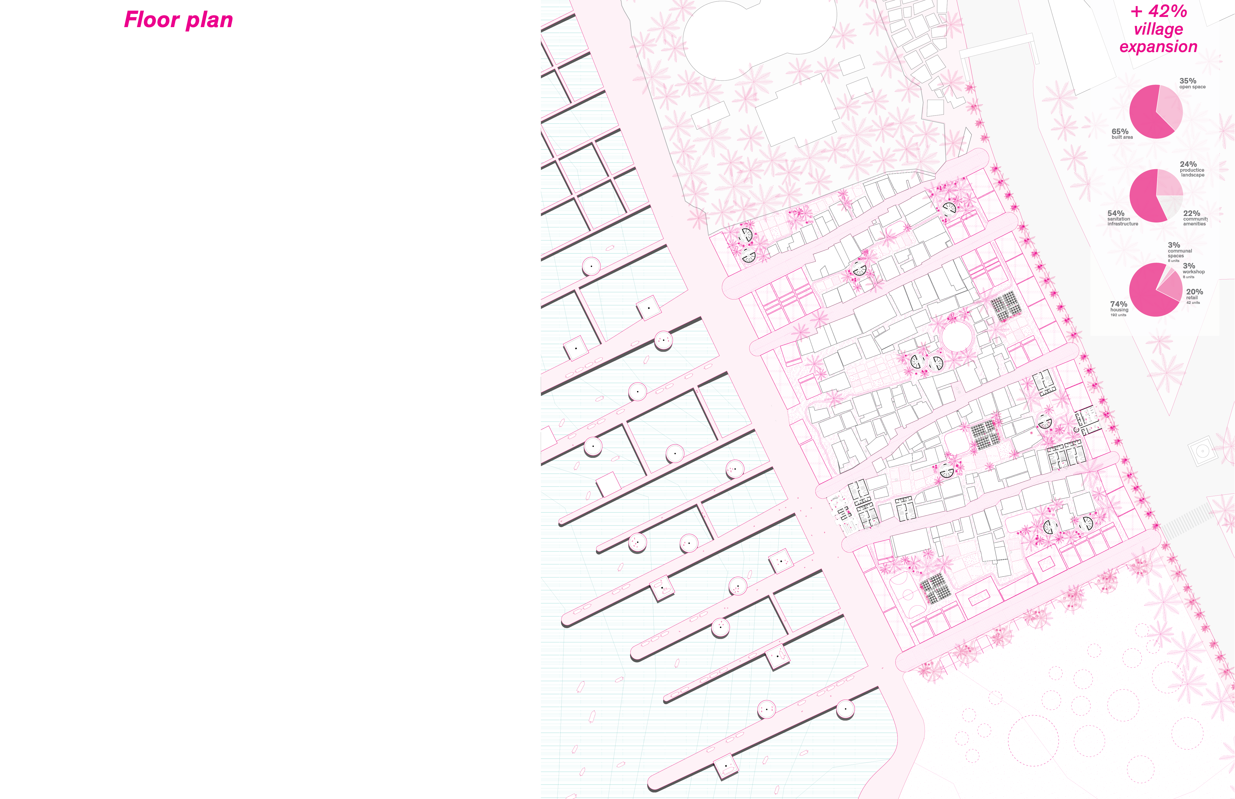
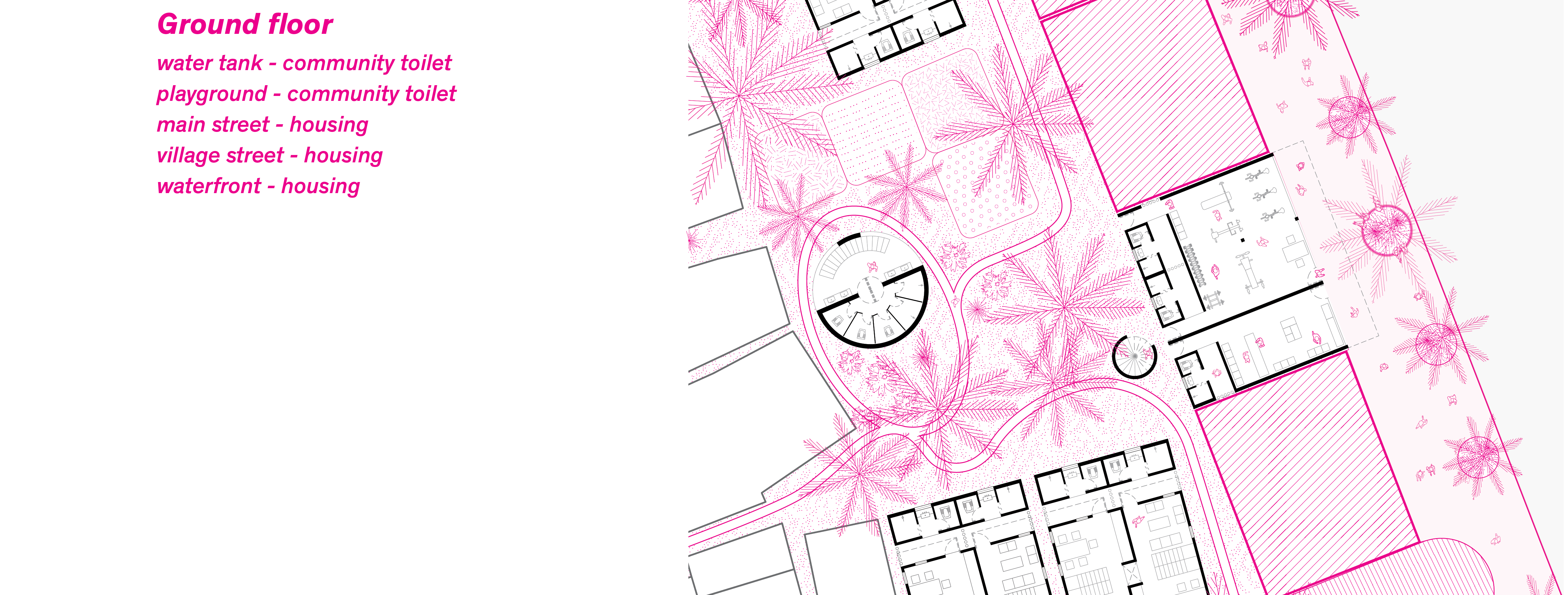
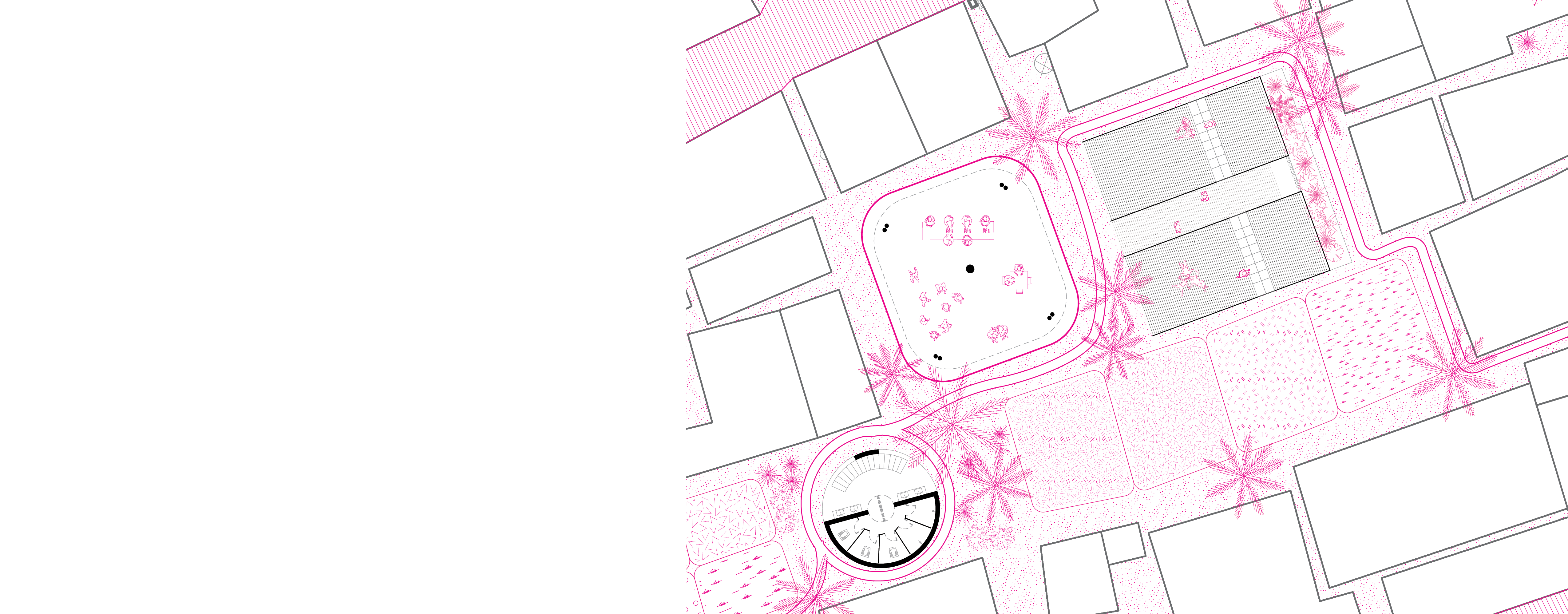
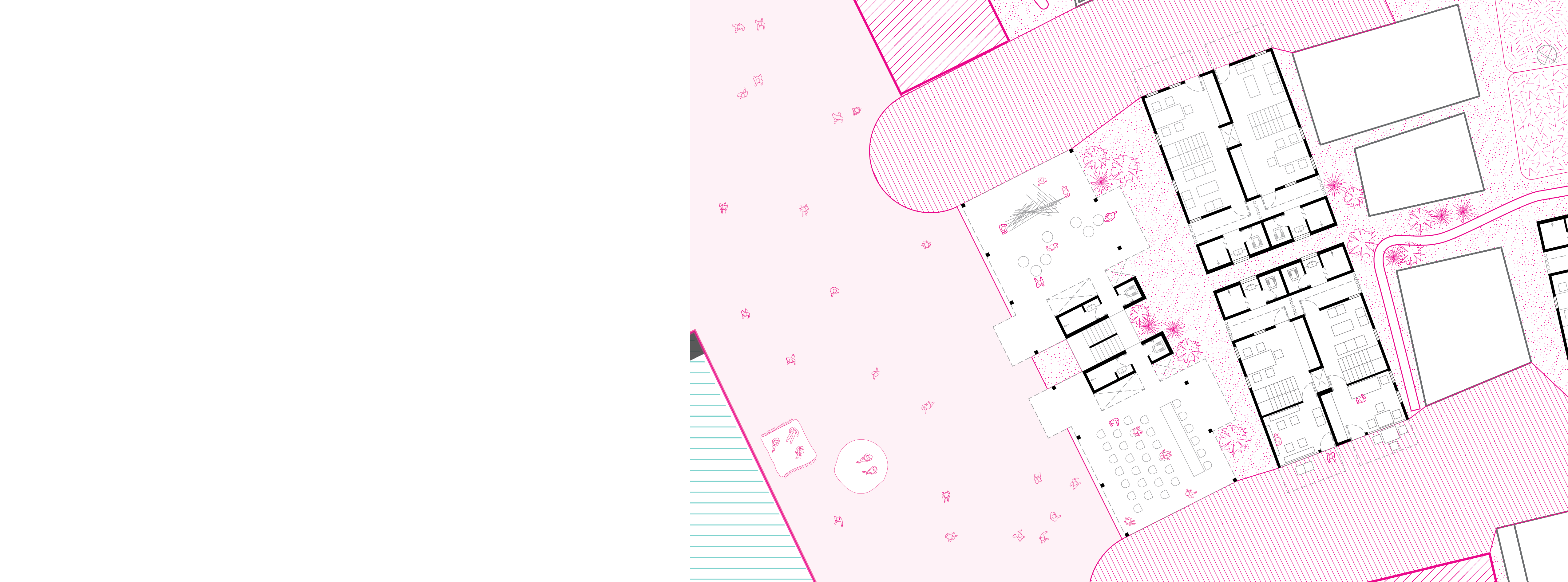
The central concern of the project is about producing space for sanitation infrastructure but it also using this as an instrument to strategically restructure the village in order to address issues of housing, edge definition urban integration and continuity of the village through time. It responds to the sanitation concerns with the design of five typologies that respond to specific circumstances on site: (1) community toilet + water tank, (2) community toilet + playground, (3) housing + main street, (4) housing + village street, (5) housing + waterfront.
Additionally, the proposal takes into account the preservation of the essence of the village. It includes the existing physical conditions along with the social and symbolic landscape of the place in order to allow its most favorable future development. Even when the project enhances the conservation of the built heritage, given the present form of the settlement it is necessary to surgically remove a few elements with insufficient light, ventilation or components in the village that have been abandoned.
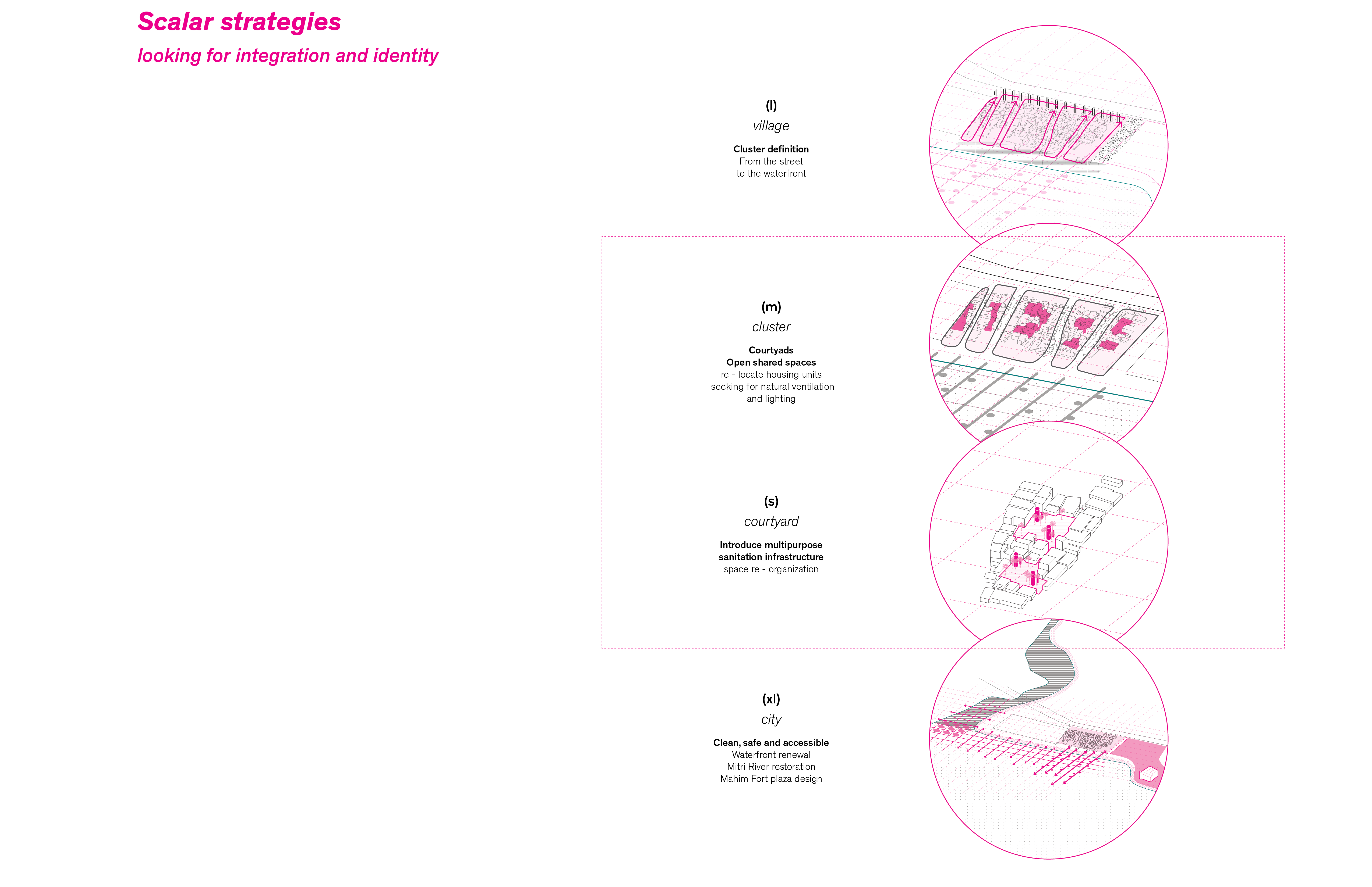
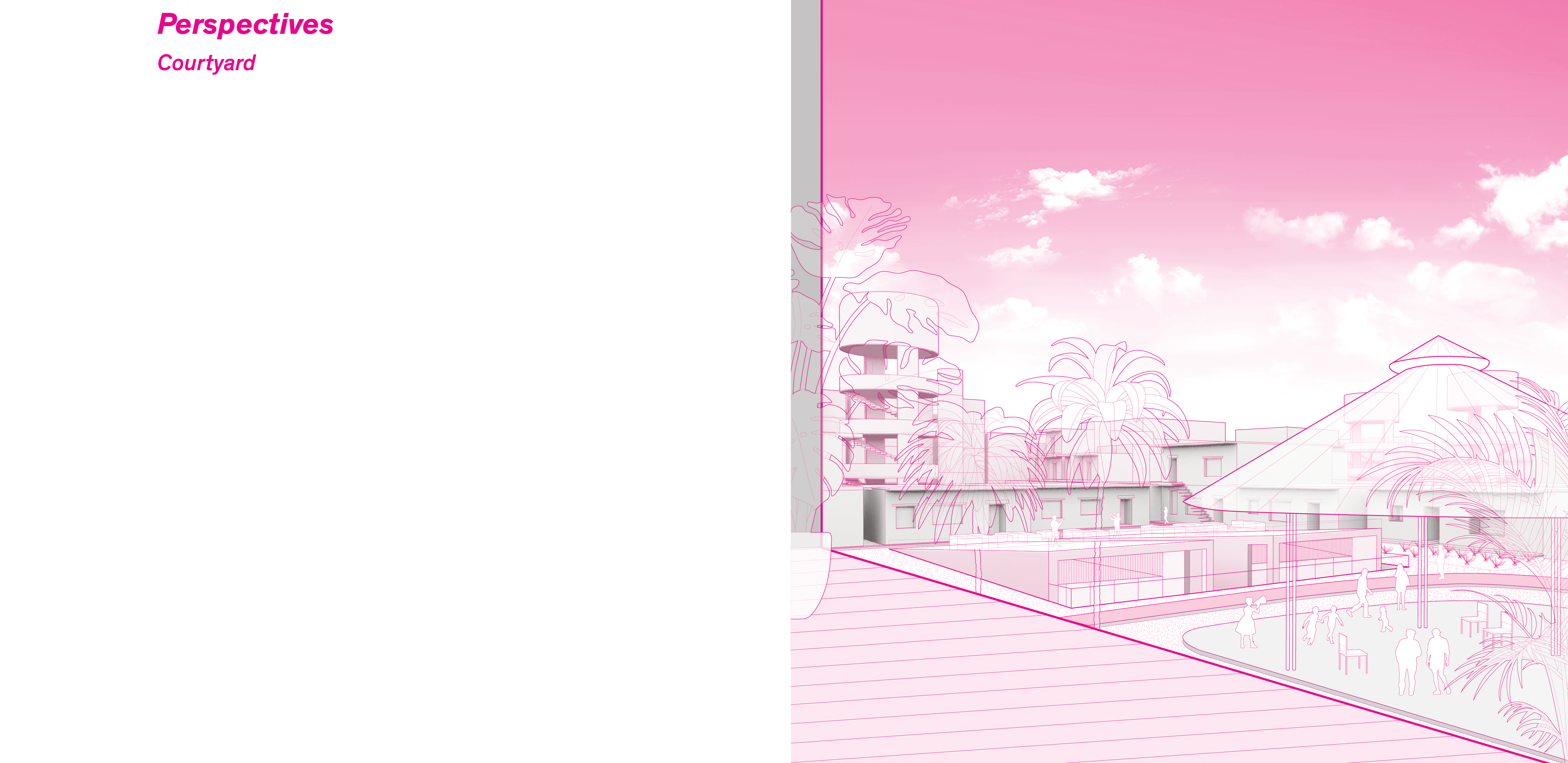
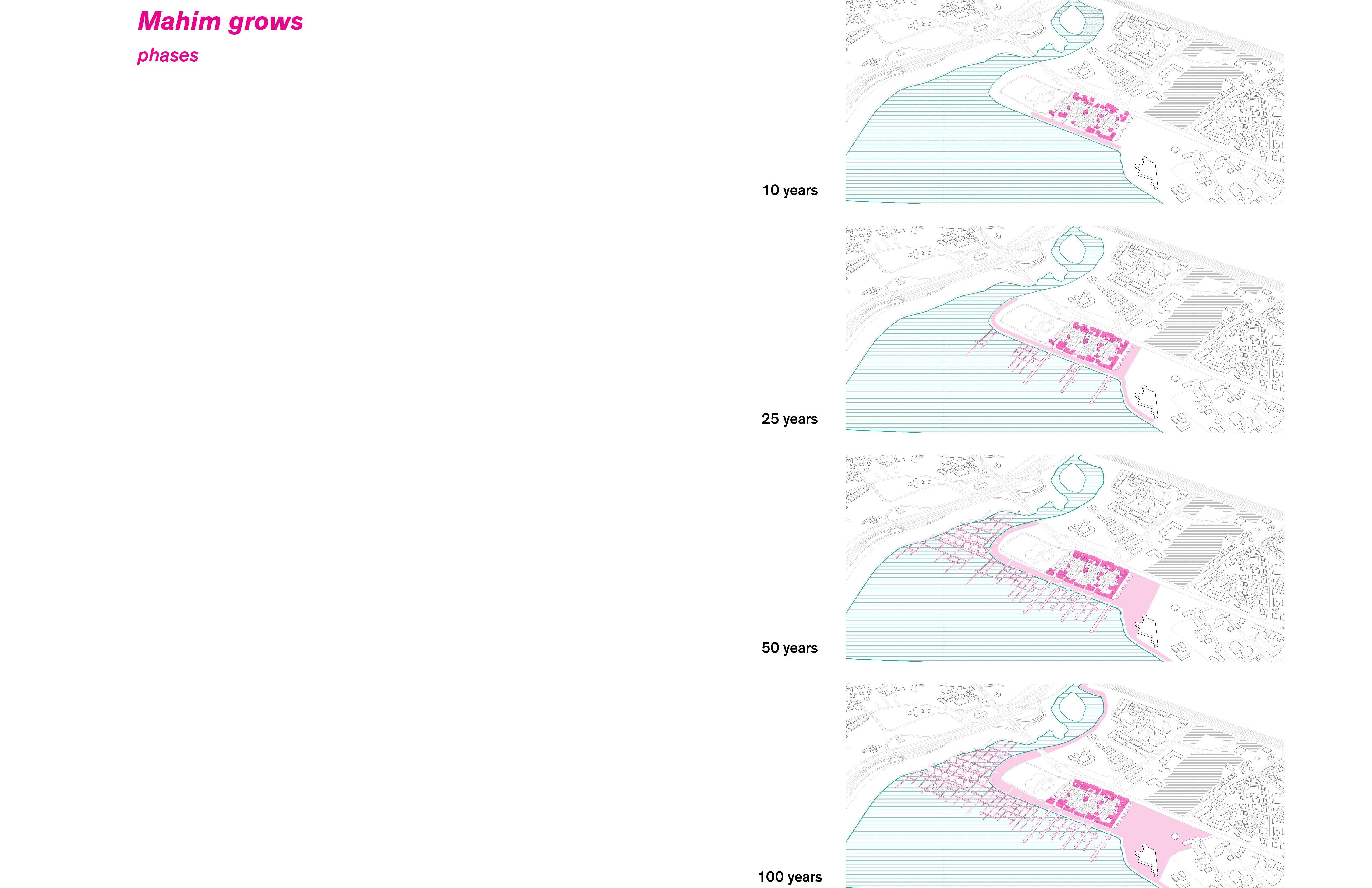
The scalar strategies of the project aim for its urban integration and identity. At the village scale the projects defines the boundaries of the new clusters, from the street to the waterfront. At the cluster scale interventions provide open space in the form of courtyards for sanitation infrastructure, productive land and vegetation. At the city scale, the project seeks to provide for a clean, safe and accessible waterfront, for the restoration of the Mithi River and for the incorporation of the Mahim Fort plaza.
Finally, the project culminates with a 100 year projection or future scenario where the village extends to the water and embrace this edge condition. On environmental climate change, this will give them agency to become once again the custodians of the ocean. It will reinforce their identity and it will provide a commercial network between other fishing villages, creating robust economic activities for the next generations.